Trinity Aquifer Sustainable Yield Study
Project Information:
- Technical Evaluations
- Development of Scientific Tools and Models
- Stakeholder Processes and Workgroups
- References and Resources
Study Background
In 2004, a study was concluded by District staff that was conducted to determine the sustainable yield of the Edwards Aquifer. This study led to the promulgation of rules to protect springflow and water levels from excessive lowering during periods of severe drought which would significantly impact the endangered salamanders that live in Barton Springs. Key aspects of the new rules were cessation of issuance of new historical permits and the allowance for permits for conditional use of Edwards groundwater. A similar effort is now being conducted for the Trinity Aquifers in the District. District staff have been studying the Trinity Aquifers for many years, but the efforts were increased in 2003 when we installed monitor wells to investigate the relationships between the Edwards and Trinity Aquifers. This included pairing single-zone Edwards wells with single-zone Trinity wells, then installation of multiport wells that could tie in multiple Edwards and Trinity zones in a single well.
The current Trinity Sustainable Yield study focusses on the potential for unreasonable impacts from pumping from wells or well fields. A definition for unreasonable impacts is given in District rules. These rules came about following passage of House Bill 3405 in 2015 which brought about annexation of a portion of Hays County into the District. The key objectives of this study are to:
- determine potential for unreasonable impacts from localized and regional pumping on water levels, wells, and springflow.
- evaluate the combined effects of pumping and extreme drought on water levels, wells, and springflow.
- provide a scientific basis for any rules that would need to be promulgated following the study.
The concepts specified in the District’s rules for unreasonable impacts can be summarized as:
- Impacts from specific permit requests
- Impacts from severe drought
- Impacts from increased pumping over a broad area
Some of the hydrogeologic concepts to be evaluated are:
- Hydraulic relationships between Trinity hydrogeologic units, horizontally and vertically
- Influence of faults and other structures on groundwater flow
- Impacts of drought on water levels, spring flow, and stream flow
- Variations in transmissivity and water quality
- Surface and groundwater interactions
- Sources and magnitude of recharge
- Geochemistry of spring discharge water and groundwater
What is “sustainable yield” ?
The District defines sustainable yield of an aquifer as the amount of groundwater that can be pumped from an aquifer without causing undesired results. Examples of undesired results are wells ceasing to yield groundwater and reduction or cessation of springflow due to excessive pumping.
The Trinity is a complex aquifer system exposed at the land surface in the Hill Country west of the District. The Trinity Aquifer in the Hill Country is the primary aquifer and sustains springflow and streams. The Trinity Aquifer also extends beneath the Edwards Aquifer to the east within the Balcones Fault Zone and within the District.
Technical Evaluations
Back to Top>>
To understand and manage an aquifer system, scientists and managers must have a good understanding of how the aquifer functions. This is the foundation for science-based policies. Understanding of the aquifer comes from a broad spectrum of studies and data. From these studies scientists and groundwater managers can constrain the sustainable yield of an aquifer. Some of those broad categories of topics, and some examples recent studies, include:
Geology
The distribution of the various geologic rock units, faulting, fracturing, and karst development are fundamental to how the aquifers function. An understanding of the geology can lead to an understanding of recharge to an aquifer, flow of groundwater through an aquifer, and discharge to wells or springs. Tasks include:
- Field mapping of karst and other geologic features such as faults and geologic units are critical to understanding the aquifers.
- Geophysical logging of a well is a tool that provides detailed information on the geology from wells. From these data the orientation and thicknesses of the geologic formations that make up the aquifers can be mapped in the subsurface.
Aquifer Recharge
- Rainfall and weather data allow us to better understand the drought, flooding, and recharge processes at work and correlate to other aquifer data.
- Stream-flow measurements can help quantify recharge to an aquifer my measuring differences in surface water flow between key points along the stream. Examples include recent studies that documented losses (recharge) to the underlying aquifers in the Blanco River and Onion Creek.
- Delineating recharge areas that contribute to the aquifer or to springs (springsheds) are also important to understand the impacts of pumping on springflow.
- Dye-trace studies involve placing dye in a recharge feature then observing which wells and springs receive the dye. These studies are often used to help us understand the fate of recharge into the aquifers, such as along the Blanco River.
Water levels
Groundwater levels provide critical information about the hydrologic relationships of recharge and discharge to storage within an aquifer, and the direction of groundwater flow.
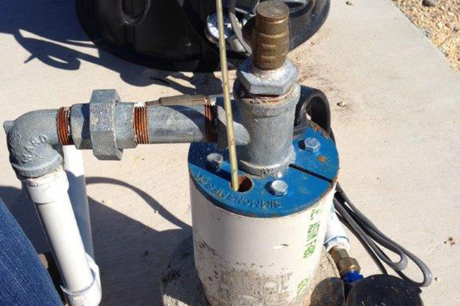
- Monitor wells are wells that are instrumented to record water levels that reflect the changes in an aquifer due to changes in rainfall amounts and pumping over time. Monitor wells are critical for many studies and management activities including drought declaration and conservation measures.
- Water-level maps offer insights into the functioning of the aquifer by indicating regional flow, discharge and recharge areas, in addition to areas of drawdown in an aquifer. These are also the focus of the Desired Future Condition (DFC) regional water planning efforts.
- Multiport and other multi-level monitor wells. These are specialized monitor wells that give very detailed information on the water chemistry, permeability, and water levels at different depths within a single well. These wells have demonstrated that the underlying Middle Trinity aquifer is not connected to the overlying Edwards aquifer.
Water Quality
District staff routinely sample groundwater wells and springs for general chemistry of the samples. District staff have sampled over 800 sites since 2000. Over the past 10 years, groundwater samples have been collected and analyzed for analysis of isotopes. Results of these analyses further help characterize the residence time and source areas of the groundwater and are used in most studies.
- Most of the water-quality data collected by the District is warehoused by the Texas Water Development Board and is available online through their Water Data Interactive Viewer.
Aquifer (Pumping) Tests
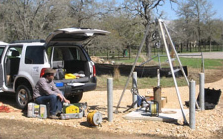
An aquifer test is conducted by pumping a well for one to 5 days while measuring drawdown of water levels in the pumping well and in nearby observation wells. Key aquifer properties such as permeability and storage capabilities can be determined from aquifer tests. These data help us to estimate potential unreasonable impacts directly, or by using the properties within models. All permits over 2 million gallons per year are required to conduct aquifer tests according to District standards.
Development of Scientific Tools and Models
Back to Top>>
Conceptual Model
A conceptual model is how scientists take all the studies and data to describe how the aquifer functions. A conceptual model is usually described in a written report. A sound conceptual model is the first step in developing a numerical (computer) model that can be used to help evaluate the range of pumping amounts that could be considered sustainable. A conceptual model is continually being updated as new data or studies are conducted—that is the process of science. Over time a conceptual model may be revised, which in turn will influence other tools such as numerical models.
- Groundwater Flow Systems in Multiple Karst Aquifers of Central Texas
- An Evolving Conceptual Model of the Middle Trinity Aquifer in Hays County , Central Texas
Groundwater Modeling
There are two key types of models used for analysis of aquifers: analytical and numerical. Analytical models are the best tools for predicting the impacts to wells from pumping within a limited distance and a given amount of time. Numerical models are more complicated and allow for the evaluation of impacts to water levels and springflow over time and over broad areas. Both types of modeling allow for the assessment of unreasonable impacts from pumping. Several numerical models are being developed for the Trinity Aquifers of Hays and surrounding counties:
- Texas Water Development Board’s Groundwater Availability Model (GAM). This is a regional model covering many counties that is currently being revised. A conceptual model report was completed and they anticipate starting work on a numerical model in the next year or two, but may not be available for use in the next few years.
- Blanco River Aquifer Assessment Tool (BRAAT). This sub-regional model is currently under consideration. A conceptual model report was just completed, and it is anticipated numerical model construction could begin in the next year and it anticipated to be a tool available in the next year or two.
- Hays Trinity Aquifer Model (HaysTAM). This is the District’s (Middle Trinity focused) Trinity model that is a sub-regional model under development. This will be a specific tool to address large permit requests in Hays County. The conceptual model is completed and we anticipate an initial tool for peer review in late Spring.
Current Partners in Trinity Aquifer Studies
- Hays and Travis Counties
- Edwards Aquifer Authority
- Hays Trinity Groundwater Conservation District
- Blanco Pedernales Groundwater Conservation District
- Texas State University- Meadows Center for the Environment
- University of Texas at Austin
- City of Austin
Stakeholder Processes and Workgroups
Back to Top>>
Under construction. Please check back.
References and Resources
Back to Top>>
Documents and Presentations
- Press Release: Trinity Aquifer Sustainable Yield Study Receives Strong Support (10/23/2019, pdf)
- Hays County Groundwater Monitoring ILA (10/22/19, pdf)
- Travis County Groundwater Study ILA (10/1/19, pdf)
- Overview of Sustainable Yield Study handout for Board (10/10/19, pdf)
- Overview presentation of Sustainable Yield Study to Board (10/10/19, pdf)


