Well Registration Online Form
Check this BSEACD interactive map to determine if you are located in the BSEACD jurisdiction (blue and green areas are in District). If you are not in the blue or green area then you may be located within the Hays Trinity Groundwater Conservation District jurisdiction. Well owners in the HTGCD should register wells here.
<<BSEACD Well Owners should register their wells CLICK HERE.>>
The online form takes a few minutes to fill out. If you would prefer to print and submit a hard copy form, you can download the pdf Well Registration form. Before you begin to fill out the Well Registration Form, it will be helpful to lookup the following information if you have it available: well depth, date drilled, well coordinates, well driller.
How to Search for a Well Log (optional)
Since 2003, well drillers have been required to submit well logs online; this makes them relatively easy to find through the Texas Water Development Board’ Water Data Interactive map. Prior to 2003, well drillers submitted hardcopy logs to TCEQ; many of these logs have been cataloged according to well grid and (if luck is on your side) can be found by searching pdfs available through TCEQ’s historic well log viewer. Here are some tips and tricks, depending on the date your well was drilled.
Drill Date: 2003 – present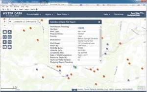
Search for Submitted Well Driller Reports through TWDB Water Data Interactive
- Use Water Data Interactive’s address search and type in your address.
- Under the Groundwater tab, check the box for Well Reports (look for orange dots). Note: purple dots are wells that have either water level or water quality data.
- Use your mouse to click on an orange dot to open the popup window with well details.
- Select the hyperlinked Well Report Tracking Number to open a pdf version of the Submitted Well Driller’s Report.
Drill Date: prior to 2003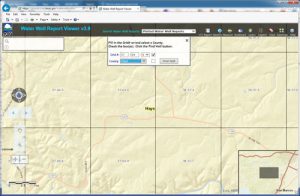
- Use Hays CAD to find original owner & Section/lot number (this will be helpful because some scanned documents do not reference a street number)
- Open TCEQ’s historic well viewer and zoom into neighborhood of interest.
- Identify the grid number that corresponds to your location of interest. Note: before GPS was widely available, drillers used a statewide grid system to approximate locations for wells.
- Select Plotted Water Well Reports & fill in Grid Number and County (Ex.: 68-08-5, Hays)
- Open first pdf and scroll through visually searching for Owner, Address or Section/Lot of interest.
- If you find it, CELEBRATE!!!!!
- Print that 1 page (not the whole pdf).
